


***Special Introductory offer - Download for FREE***
> Offline Atlas of India
> Print/Save/Share Maps
> High Quality Maps
> Individual State Maps
> District Maps (on demand)
Mapsofindia.com presents the Atlas of India, the first India specific Atlas for the iPad. With more than 50 features and maps for each specific state and district(requires active internet connection), Atlas of India is the most unique travel and information guide available in the App Store(TM).
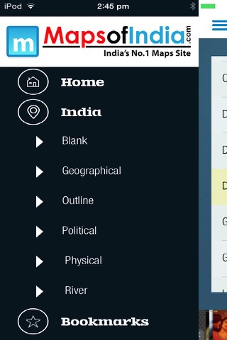
::::: India Maps :::::
India Maps are available in 6 various tastes for your use including the Physical, Political, Geographical, River, Outline and Blank Map. All these maps are of the highest quality and can directly be printed from the device or saved and sent through Mail.
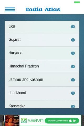
::::: State Maps :::::
Individual, high quality state maps for all the 29 States and 7 Union Territories are available for printing and downloading.
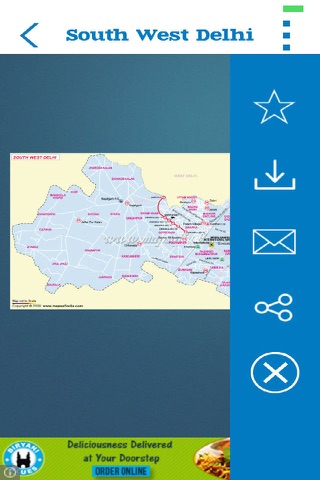
::::: District Maps :::::
The maps could be zoomed down even to the district level if you are on a WiFi or a 3G internet connection. You can also print or save these maps once they are loaded on your device from the Internet.
::::: Features :::::
~ ~ Print ~ ~
Print any map on screen through a Wireless Printer
~ ~ Download ~ ~
Save any map on screen to iPads Photo Gallery.
~ ~ Share ~ ~
Share the map through on various Social Media sites from within the app itself.
~ ~ Bookmark ~ ~
Bookmark your favorite map for future reference and for easy navigation
~ ~ Search ~ ~
Search for State or for a district from the on screen search bar. Just type in the name and the list is populated instantly
~ ~ Pinch to Zoom ~ ~
Use gestures to browse through the maps. Pinch and zoom to zoom the map in and out. Double Tap on any state or district to see exploded view.
~ ~ Detailed State Info ~ ~
Use the detailed information about the state including area, population and others.